Authors: Julie Sorfleet & Vivienne Sclater
Unmanned Aircraft Systems (UAS), commonly referred to as ‘drones,’ can be used for many things, including photography, search and rescue, and fishing. The Archbold Drone Program primarily supports the organization’s scientific research projects and the needs of state and regional conservation organizations and agencies. Archbold flights are limited to those over Archbold properties, or over partnering agency lands, respecting the privacy of private property owners. Drones are becoming more accessible and thus have been increasingly used for ecological research. Drones are able to collect information from areas that are difficult to access while also minimizing disturbance, so they have become important tools to monitor wildlife and map areas for land management.
Drones come in many shapes and sizes, from small quadcopters that can fit in the pocket of your cargo shorts, to fixed-wing drones that look like miniature planes. In the past, Archbold primarily used a DJI Phantom 4 Pro, a quadcopter about the size of a shoebox, that’s equipped with a camera that captures imagery as sharp as many traditional ground cameras. According to Julie Sorfleet, Archbold GIS Research Assistant and Drone Pilot, “The series of still images captured using drones are combined into a single large image to create aerial maps. These aerial maps provide a bird’s eye view of the ground that can be used to identify or classify areas of interest.”
Imagery from the DJI Phantom 4 Pro drone has been used to map prescribed burns and general land cover classes, as well as capture imagery of pasture productivity. Currently, it is also being used to track the movements of Gopher Tortoises for Archbold Research Intern Jack Christie’s independent research project. The drones are capturing high resolution imagery of each tortoise three times a day so Jack can analyze the habitat use and movements of the tortoises within the study.
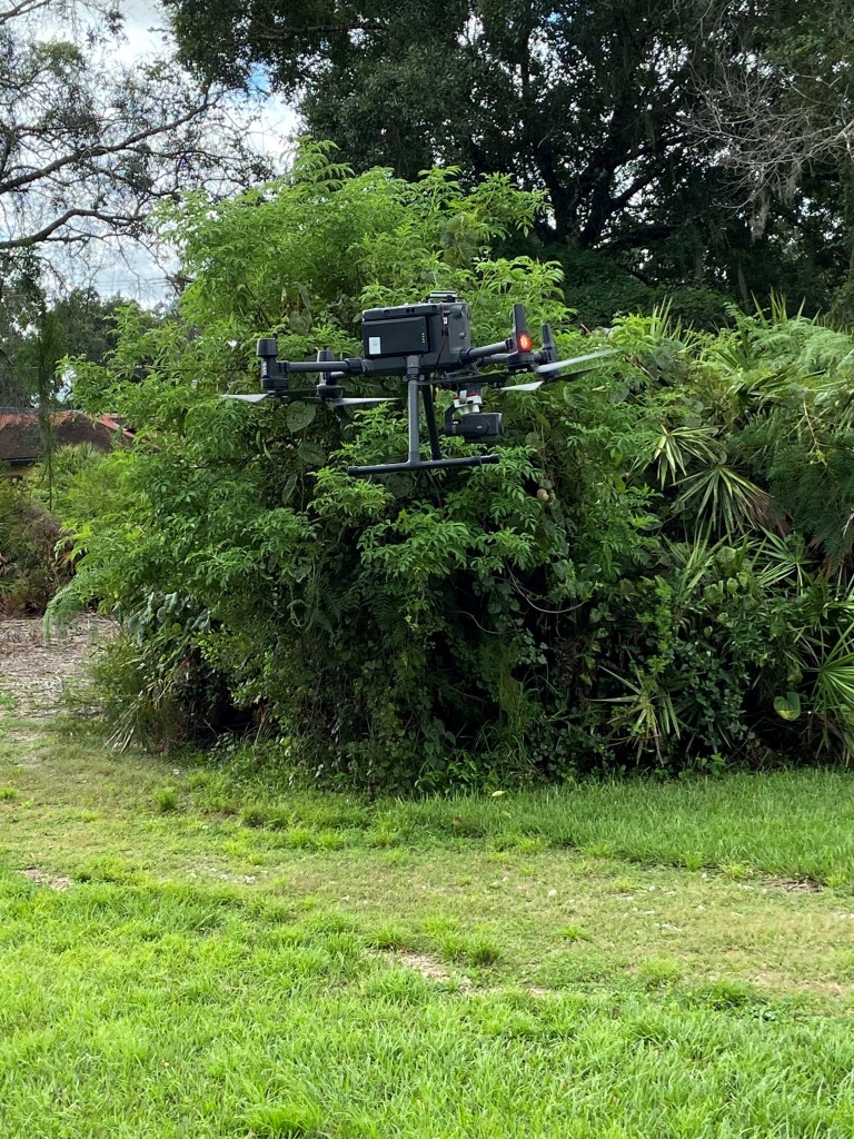
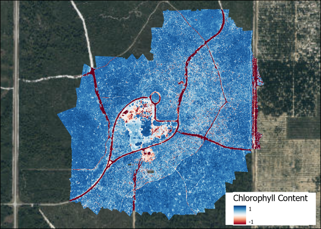
Recently, with the help of gracious donors, Archbold acquired a DJI Matrice 300 drone, a workhorse drone, which can be customized with different cameras and sensors. Archbold is currently using a multispectral MicaSense RedEdge-MX sensor attached to the Matrice 300 drone. During one flight, this sensor can capture true color red, green, and blue images along with images in the red edge and near infrared wavelengths that can be used to generate different indices. These indices are images that are produced by using a mathematical equation to combine the pixel values from the different images into a single image to highlight a specific phenomenon that is present in the environment. For example, the normalized difference between the red and near infrared can be used to quantify green vegetation as it measures the difference between the wavelengths of light that vegetation reflects and absorbs. These indices could be used to detect changes in water levels in seasonal ponds, categorize the health of vegetation, determine burn severity in a variety of habitats ranging from pastures to scrub, and determine leaf nitrogen and biomass content. Drone data do need to be calibrate in the field (are they measuring representative data) but they allow for analyses over a large spatial scale way beyond the typical small plots of intensive vegetation sampling, without having to collect extensive field data.

Other attachments that could be added in the future to the drone include LiDAR sensors. These use a laser to measure the time it takes for the reflected light to hit an object and return to the sensor. LiDAR is great for creating three dimensional representations of areas and measuring vegetation height. Sorfleet, remarked, “If we had access to a LiDAR sensor, we could couple high resolution multispectral imagery like that captured with the MicaSense RedEdge-MX sensor with height information to gather a full three-dimensional vegetation picture from the air”. Drone technology today leads to endless possibilities for the everyday person to see the world from a different perspective, the photographer to capture unique shots, the search and rescue team to cut down on their response times, and the researcher to capture new data in new ways. Drone technology is for everyone!

