Author: Xukai Zhang
Since the first satellite was launched into orbit in 1957, satellites have been integrated into our everyday lives, even though they are in orbit hundreds or even thousands of miles above us. Daily satellite applications assist by providing the first weather forecast in the morning to know how to dress up, navigating your trip to a beautiful but strange place, and even help with paying for your coffee with your debit card through a satellite link between the coffee shop and your bank. In addition to these daily applications, some satellites equipped with sensors (special cameras) are also used by scientists to ‘sense’ things about the Earth, a science known as satellite-based remote sensing.
It would not be surprising if you have wondered how satellite-based sensors observe the Earth from space. Some sensors ‘see’ the same visible light that is seen by the human eye (red, blue, green, wavelengths), while other sensors also measure the ‘invisible light’ that is not detectable by the human eye (e.g. ultraviolet and infrared). The objective of satellite-based remote sensing is to help us understand the Earth better by recording and analyzing the energy from visible and invisible light or wavelengths reflected or emitted from the Earth’s surface. Satellite-based remote sensing has been used in a wide variety of fields, such as estimating yield from farm field crops, predicting the conditions in grass pastures, and monitoring active volcanoes.
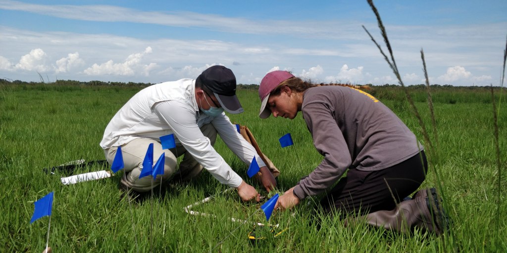
Scientific research using remote sensing is accelerating at Archbold with data from both satellite-based and drone-based remote sensing. Archbold has been among the first to apply satellite-based remote sensing to study how much plants are growing every year (a measure known as gross primary productivity), in different types of cattle pastures in south-central Florida, where Archbold’s Buck Island Ranch is conducting a project in collaboration with the University of Florida, University of Illinois Urbana-Champaign, and Cornell University. This research is contributing to the Long-Term Agroecosystem Research network supported by the United States Department of Agriculture (USDA). The project is led by Dr. Betsey Boughton, Research Director at Archbold’s Buck Island Ranch, and Dr. Xukai Zhang, her Postdoctoral Research Associate. Dr. Zhang explained, “Gross primary productivity is an estimate of the amount of energy and material entering the terrestrial ecosystem. Accurate estimates of gross primary productivity help us understand the carbon cycle from the atmosphere to plants and soil, and back up to the atmosphere. My project is designed to help us better understand the carbon cycle in Florida’s grazing lands, contributing towards the science of estimating gross primary productivity on a regional scale. It is also important to inform sustainable grassland management. I find it rewarding to think about how to scale up the data from Florida to other sites in the USDA Long-Term Agroecosystem Research network and help build the bigger picture nationwide.”
Dr. Zhang came to Archbold in March 2019 after graduating from Louisiana State University with 8 years of experience in remote sensing research. After two years of research at Buck Island Ranch, Dr. Zhang shared, “I was amazed by the beautiful scenery on my arrival at Buck Island Ranch. It was my first experience applying my research to a commercial size ranch and I felt excited by this opportunity.” One of the goals of Dr. Zhang’s research is to build a remotely-sensed gross primary productivity model and validate it using many years of plant data collected on the ground by Dr. Boughton and her research crews. Dr. Zhang built a model calculated from satellite data that produces a vegetation ‘index,’ integrating characteristics of the vegetation combined with the surface temperature of the land. He explained, “The ‘vegetation index’ is a mathematical term that combines information about two or more wavelengths measured by the satellite and reveals characteristics of vegetation. The vegetation index in the model I have produced helps us detect factors such as the beginning and end of the plant growing season and illustrates how much or how little photosynthesis is occurring in the plants.”
With a typical subtropical climate, grazing lands in south central Florida are a mosaic of improved or highly managed pastures, native grasslands, wetlands, and woodlands that provide a variety of ecosystem services, such as forage for livestock, maintaining plant and animal biodiversity, and taking up carbon as carbon dioxide from the atmosphere via photosynthesis (often called carbon sequestration, or absorption of atmospheric carbon by soil and plants). The study spans a range of vegetation types from managed pastures and wetlands at Buck Island Ranch to native grasslands and woodlands at the University of Florida Range Cattle Research and Education Center at Ona, about 50 miles west of Highlands County. Dr. Boughton noted, “The mosaic of different land uses makes it both an opportunity and challenge for studying the subtropical grazing lands by remote sensing.” Dr. Zhang added, “Another major issue is Florida’s frequent cloud cover, that intermittently blocks satellite signals.” After overcoming mountains of technical and data difficulties, Dr. Zhang has finally improved the accuracy of estimating productivity for subtropical grazing lands by satellite-based remote sensing. Dr. Boughton remarked, “Estimating productivity of grazing lands is like feeling the pulse of grazing lands and is helpful to guiding the ranch management.”
Remote sensing is a discipline continuously in movement and the future is bright. Archbold’s Buck Island Ranch not only hired its first postdoc researcher for remote sensing, but it also completed the first post-baccalaureate internship to study remote sensing: Anna Odell of Brown University. Working with Zhang and Boughton, she studied the classification of pasture types on the Ranch using remote sensing. As you are reading this article, more powerful and more accurate sensors are being developed and deployed. Myriads of scientists are currently working on new ways to analyze remote sensed data. In future we will be even better at documenting, understanding, and predicting changes in our farmlands and environments.

